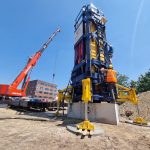



What is geotechnical monitoring during excavation?
Geotechnical monitoring during excavation is the systematic measurement and recording of ground movements, structural deformations, water pressures, and soil behavior as excavation work progresses. It gives engineers real-time data to verify that the excavation is performing within safe design limits and to detect early warning signs before they develop into serious problems. The sections below answer the most common questions about how this monitoring works in practice.
Why is monitoring critical during deep excavations?
Monitoring is critical during deep excavations because excavation removes lateral support from surrounding soil, which causes ground movement that can damage adjacent structures, utilities, and the excavation support system itself. Without continuous measurement, engineers have no objective way to confirm whether actual behavior matches design predictions or whether conditions are deteriorating.
Deep excavations create significant changes in stress within the ground. As soil is removed, retaining walls, sheet piles, and ground anchors carry loads that shift and redistribute throughout the construction sequence. Even a well-designed system can behave differently from predictions when actual soil conditions vary from those assumed during design.
The consequences of undetected movement can be severe. Neighboring buildings may crack or settle unevenly. Underground utilities can fracture. Retaining structures can deflect beyond acceptable limits, increasing the risk of collapse. Monitoring provides early warning that allows your team to intervene before minor deviations become structural failures.
Monitoring also serves a legal and contractual function. It creates an objective record of ground behavior throughout the project, which protects all parties in the event of disputes about damage to adjacent properties or infrastructure.
What parameters are measured in geotechnical excavation monitoring?
Geotechnical excavation monitoring measures ground movement, structural deformation, groundwater pressure, and soil stress. These parameters together describe how the ground and support system are responding to the excavation at every stage of construction.
The most commonly measured parameters include:
- Settlements: Vertical movement of the ground surface and adjacent structures, indicating how much the surrounding soil is consolidating or subsiding as excavation proceeds
- Lateral displacements: Horizontal movement of retaining walls, sheet piles, and soldier piles, showing whether the support system is deflecting within acceptable limits
- Inclination: Tilting of retaining structures, buildings, or monitoring columns, which can signal uneven loading or localized instability
- Groundwater pressure (piezometric levels): Changes in water pressure within the soil, which directly affect effective stress and the stability of the excavation base
- Anchor and strut loads: Forces carried by ground anchors, tiebacks, and internal struts, confirming that the support system is functioning as designed
- Strain in structural elements: Deformation within retaining walls or support members that indicates stress levels in the materials
- Vibrations: Ground-borne vibrations from construction equipment, pile driving, or traffic that may affect nearby structures
- Crack development: Opening or widening of cracks in adjacent buildings or infrastructure as a direct indicator of differential settlement
The specific combination of parameters measured on any project depends on the excavation depth, the proximity of sensitive structures, the soil conditions, and the type of support system used. Deeper excavations in urban environments typically require a broader monitoring program covering all of the above.
What instruments and sensors are used for excavation monitoring?
Excavation monitoring uses a range of specialized instruments including inclinometers, settlement markers, piezometers, load cells, strain gauges, crack meters, and vibration sensors. Each instrument targets a specific parameter and is selected based on the measurement precision required and the conditions at the site.
Movement and deformation instruments
Inclinometers are installed in vertical boreholes or embedded in retaining walls to measure lateral displacement at multiple depths. They produce a profile of horizontal movement along the full depth of the instrument, making them particularly useful for monitoring retaining wall deflection.
Settlement monitoring points are fixed reference markers installed on the ground surface, on building facades, or on pavement. Precise leveling surveys or automated sensors track vertical movement over time. In sensitive urban environments, these points are typically installed on all structures within the zone of influence of the excavation.
Extensometers measure relative displacement between two fixed points, either vertically in the ground or horizontally across a structure. They are useful for detecting differential movement between layers of soil or between a structure and the surrounding ground.
Pressure and load instruments
Piezometers measure groundwater pressure at specific depths within the soil. Vibrating wire piezometers are the most common type used in construction monitoring because they provide stable, long-term readings and can be read remotely.
Load cells are installed on ground anchors, struts, and props to measure the forces these elements are carrying. Comparing measured loads against design values confirms whether the support system is performing correctly and whether redistribution of load is occurring as excavation deepens.
Strain gauges bonded to structural elements measure deformation directly in the material, allowing engineers to calculate stress levels and identify whether any element is approaching its design limit.
Vibration and crack monitoring
Vibration sensors record ground-borne vibrations from construction activities and assess whether levels exceed thresholds that could cause damage to adjacent structures. Crack meters or crack gauges are fixed across existing cracks in buildings or pavements to detect any widening that correlates with excavation progress.
How does real-time monitoring work on an excavation site?
Real-time monitoring on an excavation site works by connecting sensors to a central data acquisition system that continuously collects readings and transmits them to a monitoring platform accessible to engineers and project managers. This allows the team to track ground behavior as it happens rather than waiting for periodic manual surveys.
Automated monitoring systems use data loggers connected to vibrating wire sensors, tilt sensors, and pressure transducers. These loggers record readings at preset intervals, which can range from every few minutes during active excavation to hourly during quieter periods. The data is transmitted wirelessly or via cable to a central server and displayed on a web-based dashboard.
The monitoring platform applies predefined alert thresholds to the incoming data. These thresholds are typically set at three levels:
- Green (normal): Readings within expected design limits, no action required
- Amber (warning): Readings approaching design limits, increased monitoring frequency and engineering review triggered
- Red (action): Readings at or beyond design limits, immediate engineering assessment and potential work stoppage required
When a sensor reading crosses an amber or red threshold, the system automatically sends alerts to designated engineers and project managers by email or SMS. This removes the risk of a critical reading going unnoticed between manual inspections.
Real-time data also allows engineers to compare measured behavior against the predictions made during design. If the ground is moving more than expected at a particular stage of excavation, the team can investigate the cause and adjust the construction sequence or support system before the situation escalates.
When should geotechnical monitoring start and end on an excavation project?
Geotechnical monitoring should start before excavation begins and continue until ground movements have stabilized after construction is complete. The pre-excavation phase establishes baseline readings that make all subsequent measurements meaningful. Ending monitoring too early risks missing delayed settlement or groundwater effects that develop after the main construction activity has finished.
A well-structured monitoring program follows this timeline:
- Pre-construction baseline phase: Instruments are installed and readings are taken over a period of weeks before excavation starts. This establishes the natural variation in the parameters being measured and confirms that all instruments are functioning correctly. Baseline surveys of adjacent buildings and infrastructure are also completed at this stage.
- Active excavation phase: Monitoring frequency increases as excavation deepens. The highest risk period is typically when the excavation reaches its maximum depth and before the permanent structure provides internal support. Readings may be taken continuously or multiple times per day during this phase.
- Construction of the permanent structure: As the basement or underground structure is built, loads on the retaining system change. Monitoring continues to confirm that the transition from temporary to permanent support is proceeding safely.
- Post-construction stabilization phase: After the structure is complete, monitoring continues until settlement rates have reduced to a stable, negligible level. In soft clay soils, this stabilization period can extend for months after construction ends.
The specific duration of each phase depends on soil type, excavation depth, and the sensitivity of adjacent structures. Your geotechnical engineer should define the monitoring schedule as part of the overall monitoring plan before work begins.
Who is responsible for geotechnical monitoring during excavation?
Responsibility for geotechnical monitoring during excavation is shared between the geotechnical engineer of record, the monitoring specialist or contractor, and the main contractor. Each party has a distinct role, and the monitoring plan should define these responsibilities clearly before work starts.
The geotechnical engineer of record designs the monitoring program, specifies which parameters to measure, sets the alert thresholds, and interprets the data as the project progresses. This engineer is responsible for identifying when measured behavior deviates from design assumptions and for recommending corrective action.
The monitoring specialist or contractor installs the instruments, operates the data acquisition system, and ensures that readings are collected reliably throughout the project. In automated systems, this party also maintains the hardware and communication links that keep the real-time platform running.
The main contractor is responsible for responding to alerts and implementing any changes to the construction sequence or support system that the geotechnical engineer recommends. The contractor also has a duty to report any observations on site, such as unexpected water ingress or visible cracking, that may not yet be captured by the instrument network.
On complex urban projects, an independent monitoring engineer is sometimes appointed by the client or a regulatory authority to provide an objective assessment of the data, separate from the parties directly involved in construction. This independent role adds an additional layer of oversight and is particularly common when excavations are close to heritage structures, tunnels, or critical infrastructure.
How We Support Geotechnical Monitoring During Excavation
We provide geotechnical monitoring services that cover the full range of parameters relevant to excavation projects, from initial instrument design through to data interpretation and reporting. Our team works with you from the pre-construction baseline phase through to post-construction stabilization, ensuring that your project has continuous, reliable data at every stage.
Our monitoring capabilities for excavation projects include:
- Settlement and displacement monitoring using precision sensors and automated data acquisition systems that deliver real-time readings to your project team
- Vibration monitoring and prediction to assess the impact of construction activities on adjacent structures and to confirm compliance with vibration limits
- Groundwater and pore pressure monitoring using vibrating wire piezometers connected to our remote data platforms
- Strain and load monitoring for retaining structures, anchors, and struts, providing direct confirmation that your support system is performing within design limits
- Crack monitoring of adjacent buildings and infrastructure, with automated alerts when movement exceeds agreed thresholds
- Independent technical review and second opinions for projects where an objective assessment of monitoring data is required
We also develop and supply our own monitoring hardware, including the PDR data acquisition unit, which can be configured for a wide range of sensor types and deployed in demanding site conditions. Our engineers combine hands-on field experience with deep expertise in geotechnical analysis, so the data we collect is always interpreted in the right engineering context. For projects that also require foundation verification, our pile load testing services for foundation projects can be integrated alongside your monitoring program.
If you are planning an excavation project and want to discuss a monitoring program tailored to your site conditions and risk profile, contact our geotechnical monitoring team directly to get started.